Declination | NWCG provides a good explanation and description.
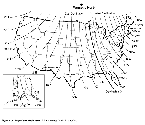
They start with a map (in this case of the USA, with possibly out of date values) that shows lines connecting locations with equal declination:

For instance, if you were in California (left coast) the declination is about 10°E.
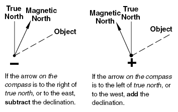
That means that the compass is pointing too far to the right (East).
Or, if you were in Delaware (right coast) the declination is about 10°W.
That means that the compass is pointing too far to the left (West).

I currently live in Albuquerque New Mexico which currently has a magnetic declination of 8.00°E.
Your compass is pointing 8° east of where it should be pointing.
So to go due north, you should be walking 8° to the left of the needle.
It's not likely to be a factor when walking, but if you were flying long distance, you'd also need to be aware that the declination will change as you move farther north through Colorado, Wyoming, and Montana.
By the time you cross the Canadian border, the declination will have increased to about 15°E.
And if you reach northern Canada, the declination changes rapidly enough that in some places magnetic compasses are useless.

