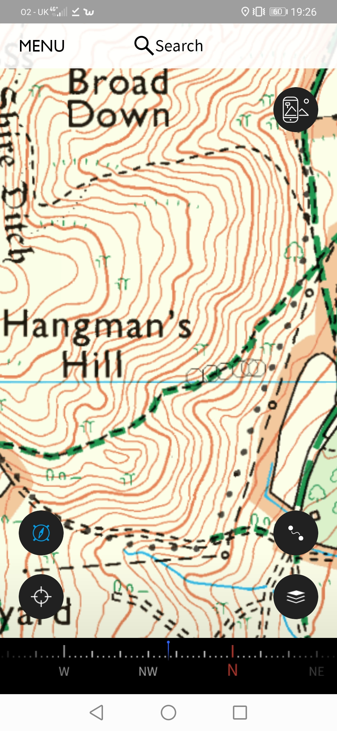
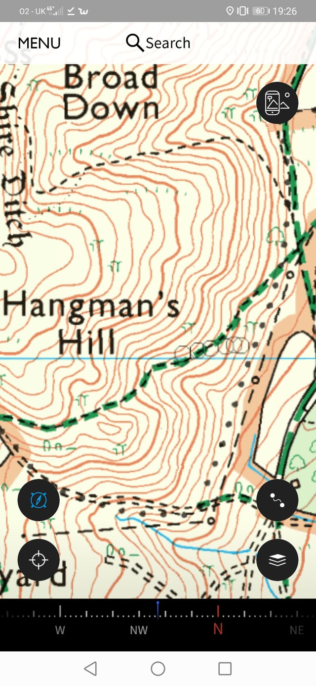
Does anyone know what this line of circles on a map represents? (the ones that start to the east of where it says Hangman's Hill) It is near Malvern. We passed some rocks but they were probably 300 meters away from the map feature, and the circles look too 'perfect' to represent rocks? It is an OS 1:25000. 
-
Did you mean 6 hollow octagons? Or a long curved line of about 30 circles?– anatolygCommented Aug 3, 2020 at 15:34
-
@anatolyg the curving line of solid black dots could be 'civil parish boundary'.– Weather VaneCommented Aug 3, 2020 at 21:06
6 Answers
Ordnance survey were asked on twitter, and replied that:
"Hi thankyou for bringing this to our attention. The circles are actually blemishes on the data which are being removed and will no longer show in future updates. Sorry if this has caused any inconvenience."
Of course they might say that if it were a fictitious entry as suggested by Darren's answer
I'm not sure what app you're using, but they're from the app, and not part of the base map.
You can view the OS map in Bing (yes, it is useful for something!) here and the circles (octagons?) don't appear. What made me think they're not on the base map though is the line weight. The screenshot embedded kin the question has been through a bit of rescaling, but if we force the "large" option at https://i.sstatic.net/67NXIl.jpg (which has a good chance of being the original size):
those lines are 1 pixel with a bit of antialiasing; even the green lines for the trees are a bit heavier, as are the minor contours, which are normally the lightest features on the map.
So what are they? They're not a common shape for waypoints, but it's possible; if they were part of your track, I'd expect a continuous line.
-
1They probably indicate successive "current" locations, ie the track. I said this earlier but OP did not confirm he walked that route.– Tomas ByCommented Sep 18, 2020 at 16:53
-
@TomasBy I've never seen multiple large symbols like that used to mark a route. A route would be a line. It's possible they're multiple rough fixes but I wouldn't expect them to all be the same size in that case. The do appear to roughly follow the path, so if the path wasn't clear it could be a track– Chris HCommented Sep 18, 2020 at 17:30
-
1
-
@TomasBy if the op came back we might find out. For all we know they're geocaches or something– Chris HCommented Sep 18, 2020 at 18:43
Nothing appears there on the satellite view, although the tree cover could well be concealing whatever it is.
My best guess at the moment is that this is a fictitious entry that is added by cartographers to catch out copyright violators who blatantly rip off their work.
These fake entries also go by the names “Mountweazel”, “Trap Street”, and others depending on the type of work they appear in, named after famous examples.
-
3The Ordnance Survey have repeatedly said they do not use Copyright Traps on their maps: 'She stressed that Ordnance Survey’s “fingerprints” did not extend to putting misleading features in maps: “There are some publishers who put deliberate mistakes in their maps. We don’t do that - it would mislead our customers. For us, it’s more about the style we use.”' From theguardian.com/uk/2001/mar/06/andrewclark This also matches with chats I've had with a number of their employees. Commented Sep 9, 2020 at 14:03
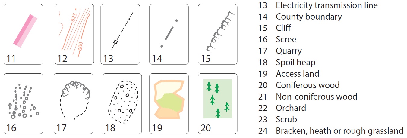
I had a look through the symbols/legend for the ordnance survey maps here (PDF), and could find nothing that matches exactly the type of symbol you have shown.
The closest were boulders (under Heights and Other Natural Features), but these would be normally oval/irregular shapes rather than circles, and with a heavier weighting on the line. The other possible match is "other pit or quarry" under General Features, but this would be associated with a dashed line that outlines the general boundary of the pit or quarry.
Ordnance survey has, as of 2010 imposed more strict copyright claims on its maps (see information here under Ordnance Survey), so it is entirely possible that these are either printer's marks or as @Darren suggested placed there to catch copyright infringement.
-
Thanks everyone, the fictitious entry sounds like a sensible answer. The fact that they are overlapping and all the same size and shape, along with being reasonably faint suggests that they are not marking a feature.– Djw1288Commented Aug 2, 2020 at 21:41
-
The Ordnance Survey have repeatedly said they do not use Copyright Traps on their maps: 'She stressed that Ordnance Survey’s “fingerprints” did not extend to putting misleading features in maps: “There are some publishers who put deliberate mistakes in their maps. We don’t do that - it would mislead our customers. For us, it’s more about the style we use.”' From theguardian.com/uk/2001/mar/06/andrewclark This also matches with chats I've had with a number of their employees. Commented Sep 9, 2020 at 14:02
-
@Mehmet in fairness though, that article is nearly 20 years old. Things could have changed in the meantime.– DarrenCommented Sep 9, 2020 at 15:26
-
@Darren I do see what you mean. I'm a Mountaineering Instructor in the UK and over the past year I've had conversations with an OS employee who adamantly assured me the OS do not use copyright traps. As this was a conversation I don't have sources and the article above was the best written evidence I could find. I hadn't noticed it was nearly 20 years old though. Commented Sep 13, 2020 at 7:31
The closest match with the 1:25000 OS map symbols that I can see is #16 scree.
The circles are not shown on the 1:50000 map and there is no scree symbol for that map range either.
The circles are all the same size: perhaps there are just a few small distinct patches of scree.
According to the OS themselves, and as previosuly suggested, it is a civil parish boundary: https://www.ordnancesurvey.co.uk/documents/resources/25k-raster-legend.pdf
-
2The feature in question is the 6 octagons slightly right of center. Those do not show up in the guide you link to. Commented Sep 18, 2020 at 13:21
-
1It is not clear where in the guide you are referring to. It would be helpful to others if you were able to indicate where in the guide you are referring to, perhaps by giving the heading it appears under. Also, are you sure you are referring to the same symbols (6 overlapping, faint circles) being discussed or have you picked out something else? Commented Sep 21, 2020 at 13:24

