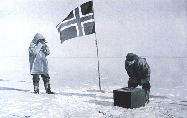
I'll expand a bit on how one would use a sextant to locate the north or south pole.
The basic arrangement needs a horizontal reflective plane, for which Amundsen used a pool of mercury. A precisely weighted mirror could work also, but a pool of mercury is more robust and doesn't go out of calibration. Sextant measures the angular distance between two visible objects, in this case between the sun and its reflection in the horizontal surface.
This angle is twice the elevation of sun above the horizon. If you are standing at exactly the north (or south) pole, sun will remain at the same elevation all through the day. There will be a small linear change due to earth's orbit around the sun, but no cyclic 24-hour change because you are on the earths rotational axis.
Now, you can take multiple measurements over the day and draw a graph. Even though sun remains at the same elevation, it will still move in a circle around you, so each measurement corresponds to a different direction.
If the elevation graph is flat, you have found the pole. If it however resembles a sine wave, you can use the information to move closer to the pole. The direction where the sun's elevation is lowest is towards the pole, and the distance to the true pole can be calculated from the difference between lowest and highest elevation.
