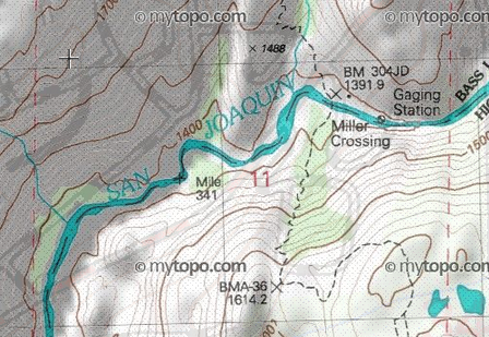
There are two kinds of USGS maps. Two articles on directionsmap.com explain the situation:
In a nutshell, the old-style maps prior to 1992 are normal topographic maps, hand-drawn and manually explored. The new style US topo are fully automated, two orders of magnitude cheaper to produce, and lack most information expected on a topographic map: fences, parks, recreational trails, railroads, boundaries, pipelines, power transmission lines, buildings, names for most landmarks, and more. The new style US topo, as it is now, is useless for outdoor recreation. However, USGS are working to add more information to these maps, to improve visual presentation, and to offer paper maps. Among other things, they are planning on adding recreational trails in national forests.
From the aforementioned articles:
- The Original Topographic Mapping Program
(...)
In the original 7.5-minute topographic mapping program (circa 1945 - 1992), the USGS contracted aerial photography and sent government employees to the field to survey the map area. Field crews established horizontal and vertical control, located and classified cultural features, located permanent survey markers, hiked wilderness trails, classified natural features such as streams and swamps, collected boundary information from state and local governments, and investigated geographic names by interviewing local residents.
(...)
US Topo quadrangle maps are mass-produced using automated and semiautomated processes. The cartographic content comes from national GIS databases.
(...)
Many features traditionally captured by direct field observation are not in any public domain national database. Examples include minor features such as windmills, water tanks, fence lines, local parks and recreational trails, but also more important features such as boundaries, pipelines, and power transmission lines.
However, USGS are planning to add more information in the coming years:
The second strategic goal of the program is continuous product improvement, which can be divided into two broad categories.
Additional Data Content
(...)
Additional content planned for 2013 includes a shaded relief layer, National Parks and other selected federal land boundaries, and recreational trails in National Forests. In all cases, new content depends on receiving data from authoritative sources. For non-natural map features, the USGS no longer gathers data by direct field observation or from primary sources.
Conclusion: old-style USGS maps are reasonable but may be outdated. New-style US topo maps are useless for outdoor recreation.


